by Stephan G. Schmid, Zbigniew T. Fiema and Bernhard Kolb
I. Introduction
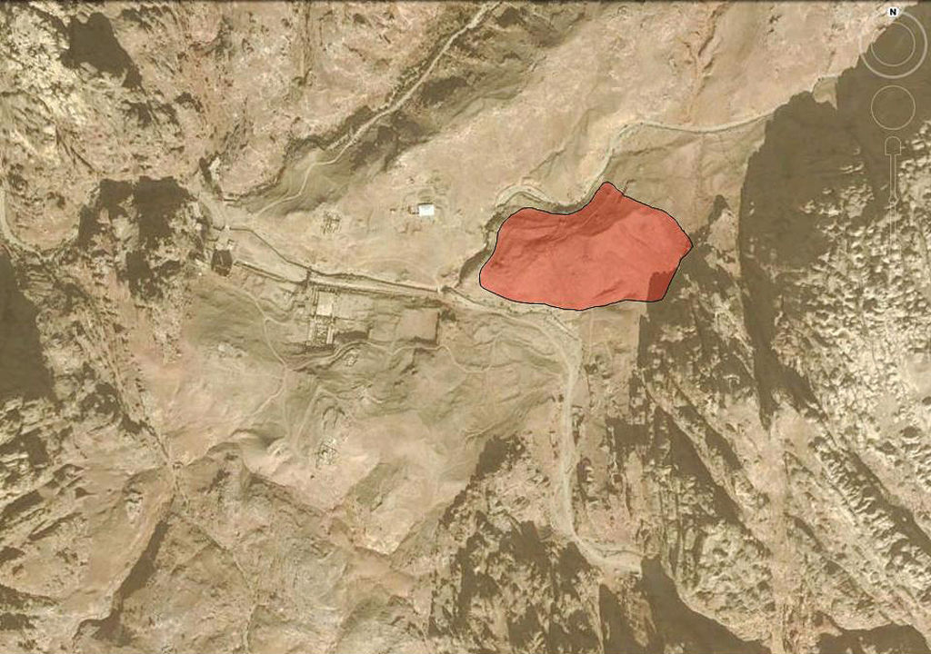
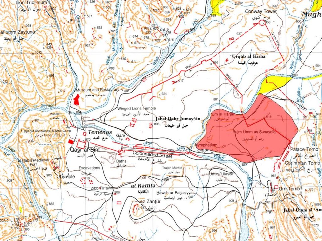
The North-Eastern Petra Project (NEPP) conducts an intensive surveying, mapping and documenting in the area of NE Petra (site marked as Rujm Umm al-Sunaydiq), being roughly the quarter of the city centre, between the Wadi Mattaha, the Wadi Musa and the Palace Tomb (figs. 1. 2). The ruined structures located there have, so far, been neither very extensively described nor fully and scientifically documented. The planned activities for 2013 included:
description, measuring and photographing of the extant ruined structures at the site;
advanced electronic documentation of the entire complex in order to provide a reliable map of the area.
The NEPP site – consisting of several large ruined architectural entities – is located directly NE of the confluence of the Wadi Mattaha and Wadi Musa drainages, on the high hill overlooking the eastern end of the Colonnaded Street, and west of the Palace Tomb in Petra. The site is ca 250 m (E–W) x 150 m (N–S). Its northern extremity is occupied by Umm al-Harjal and the eastern one by Rujm Umm al-Sunaydiq, the latter seemingly being the name of the entire area.
It is most surprising that all relevant, modern maps of the Petra's center feature almost no extant structures or ruins in this area despite that fact that these are clearly visible and quite significant in appearance. This fact is not only puzzling but, in fact, most detrimental for the Petra's future. The area which the NEPP investigates witnesses almost no tourist activities despite its apparent interest. Most visitors to Petra do not even attempt to venture up to the Palace Tomb and the few who do so, either go down towards the Wadi Musa, walk along the monumental tomb facades toward the Tomb of Sextius Florentinus, or simply climb up to Jabal al-Khubta. Hardly anybody visits the NEPP area, unless crossing it over in order to reach the Petra church on the other side of Wadi Mattaha, connected to the NEPP area by a small modern bridge.