The International North-Eastern Petra Project

Preliminary Report on the 2014 Season

by Stephan G. Schmid, Zbigniew T. Fiema and Bernhard Kolb

III. The 2014 survey season – other structures and finds

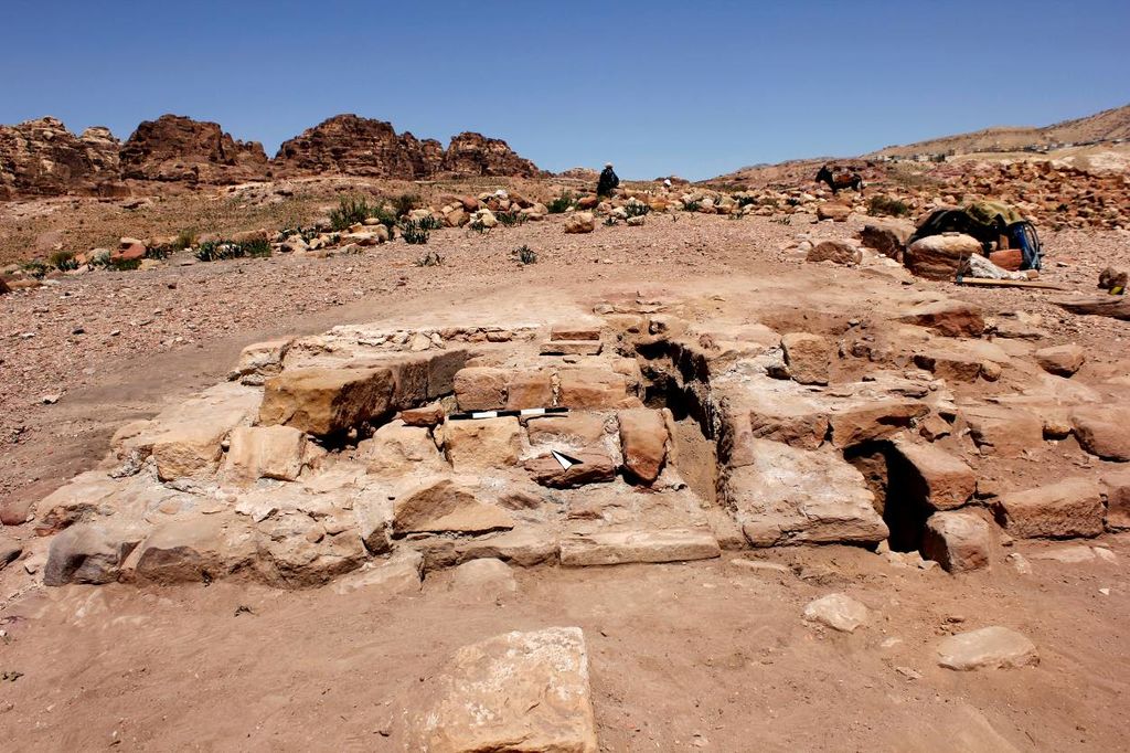
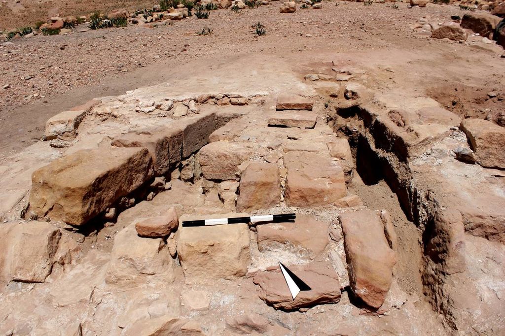
Additionally, the NEPP team produced detailed plans and interpretive descriptions of some smaller, water-related, installations. Installation WS1 is a well-defined castellum divisorum located in the south-central part of the area (fig. 22). It features two major phases of existence. In the first phase, either aqueduct-generated water or rainwater conducted to the area by a conduit, was channelled into a large basin lined up with the waterproof mortar, from which it was distributed elsewhere through a single outlet. Additionally, a masonry-built water channel was installed abutting the eastern side of the basin. In the second phase, possibly following some damage, the space of the basin was built over, including two well-defined masonry water channels with outlets leading water into two different directions (fig. 23). The eastern water channel continued to be in use. The entire installation is a very good example of water distribution installation in an urban area, which is a part of major water supply system.

Fig. 22: Water Structure 1. Castellum divisorum. View from S (photo: M. Dehner)
Fig. 23: Water Structure 2. Castellum divisorum. Two channels from Phase 2. View from S (photo: M. Dehner)

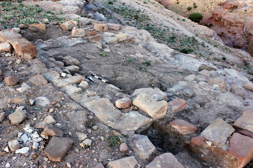
WS2 is the water installation located on a steep slope in the western part of the NEPP area. It consists of two large basins located one after the other but on the different levels. Both basins feature waterproof mortar. Apparently, the upper basin served as a settling tank for the rainwater (fig. 24). The lower basin received water free of sediment, which was then distributed elsewhere. Finally, installation WS3 also studied during the 2014 fieldwork season, is located near Structure 4, in the NE extremity of the NEPP area. It is a large outcrop of reddish sandstone, which has been carved out to accommodate at least three interconnected basins. The basins are located on different levels and apparently served as collecting points of the rainwater from the main plateau of the NEPP area.

Fig. 24: Water Structure 3. The upper basin. View from NE (photo: M. Dehner)

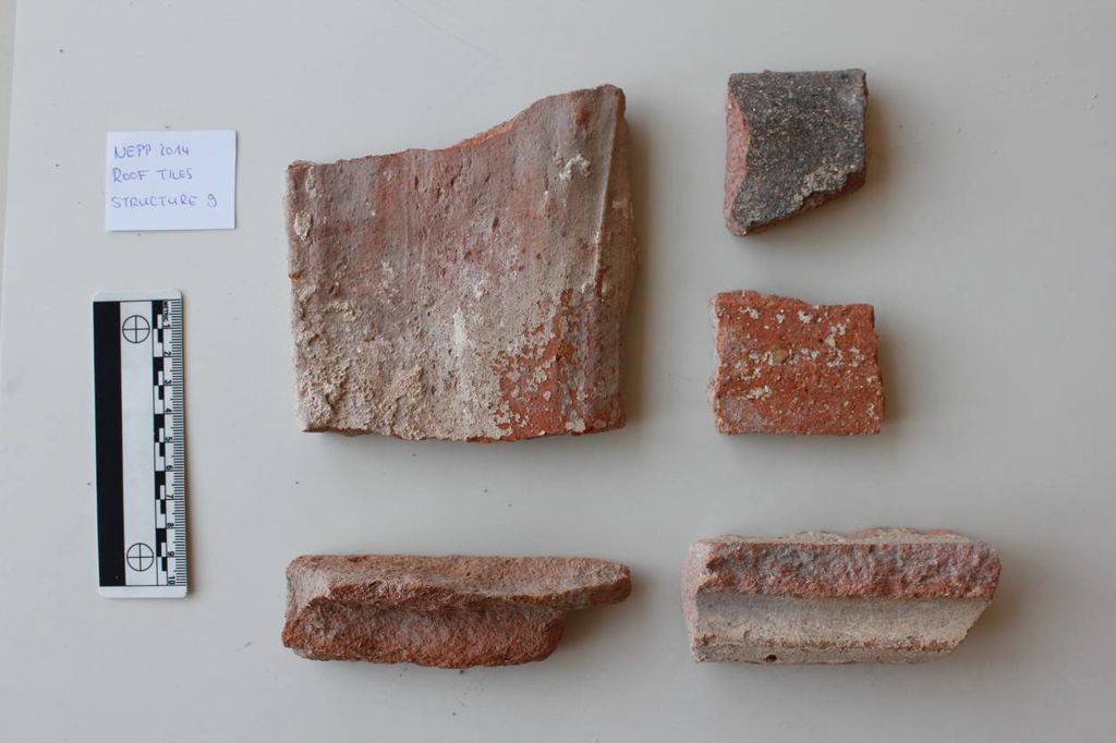
Ceramics were generally not collected from the surface as this was already done in the previous seasons. A few roof tiles were collected as sample from the surface of Structures 9 and 3 (fig. 25). This material is important as an indicator of the existence of roofs. Also, a few marble fragments were collected as a sample. Furthermore, at this point of time, altogether 476 architectural blocks were located and measured in spaces between large structures, including 72 blocks recorded during the 2014 season. The blocks range from numerous door-jambs, through column drums bases and capitals, including blocked-out Nabataean types and highly decorated Attic-Ionic types, pilaster bases and capitals, to the elements of entablature.

Fig. 25: Samples of roof tiles (photo: M. Dehner)