The International Umm al-Biyara Project
- Welcome to the International Umm al-Biyara Project
- Outline of the International Umm al-Biyara Project
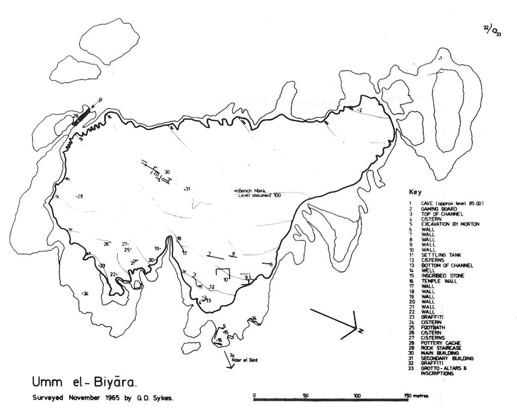
- Selected bibliography of the International Umm al-Biyara Project
- Preliminary Report on the 2014 Season
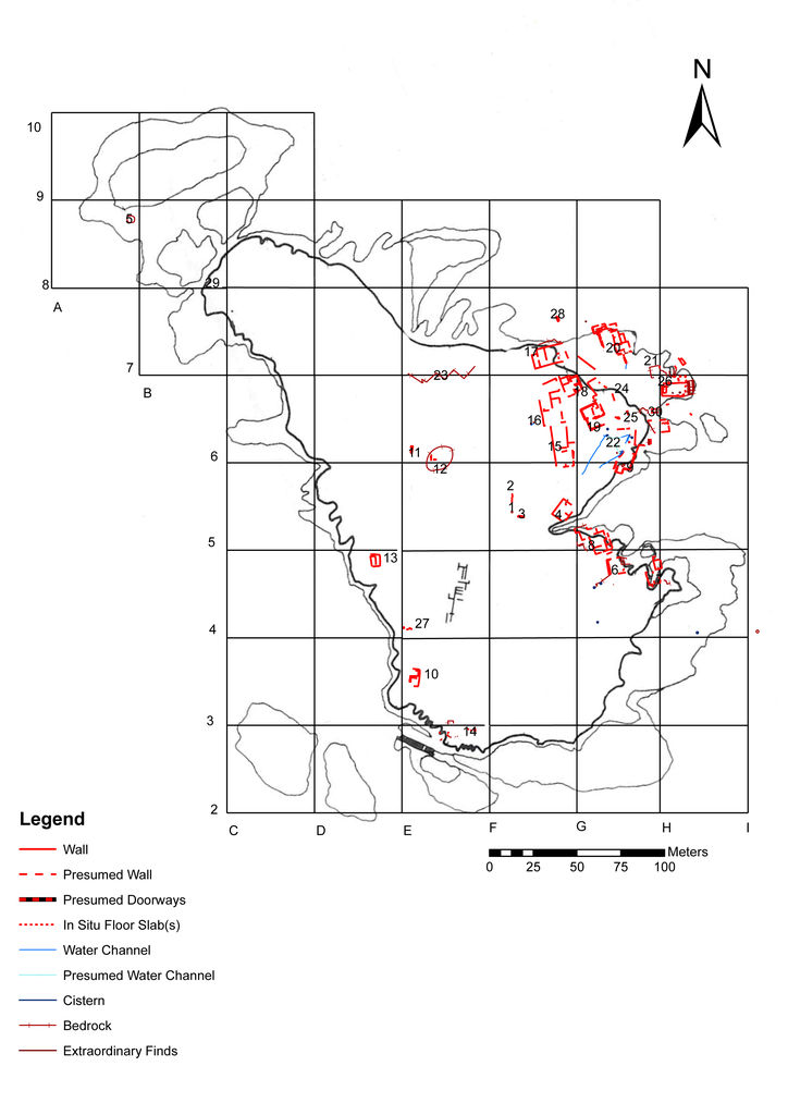
- Preliminary Report on the 2013 Season
- Preliminary Report on the 2012 Season
- Preliminary Report on the 2011 Season
- Preliminary Report on the 2010 Season
- I. Acknowledgments
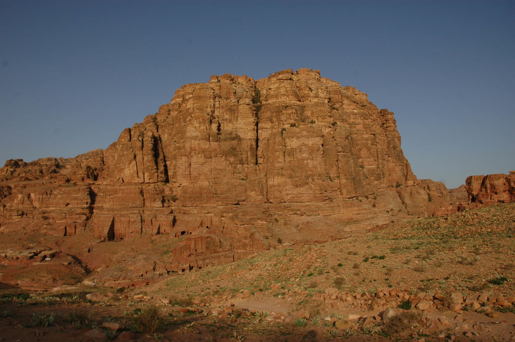
- II. Introduction
- III. First Results – a. General observations
- III. First Results – b. A watchtower?
- III. First Results – c. A luxurious bathing installation
- III. First Results – d. A room with a view
- III. First Results – e. Water management
- III. First Results – f. Parallels and interpretation
- IV. Conclusions and perspectives